“What is more beautiful than a road? It is the symbol and the image of an active, varied life.” — George Sand
U.S. Highway 50 is 3,073 miles long. It connects Ocean City, Maryland, and Sacramento, California. For much of its distance it is a two-lane highway serving local residents, while drivers from distant locations race along nearby Interstates. Nonetheless, it is clearly marked and ready for a cross-country traveler.
Route 50 is thus an anachronism: There is no longer a need for a national highway routed over mountains and rivers, along rural roads, around small-town squares, and through suburban streets and city blocks. But that is Route 50, and here is a romantic notion: The many people with houses on Route 50 can pull out of their driveways, turn east to Ocean City or head west to Sacramento, and never leave the road that passes home.
I’ve traveled the entirety of Route 50 many times, and this book is about places and things located within roughly 10 miles on either side of the highway. Since Route 50 extends more than 3,000 miles, that adds up to over 60,000 square miles. It’s a lot of territory to cover, and I don’t pretend to have covered it all. I hope, though, that some of the places I’ve visited will interest you.
Twelve days is a good length of time for a civilized trip across America. It allows interesting stops, plus restorative dining at the end of each day. This is not a guidebook, though, so you will find no evaluations of hotels, and you’re on your own choosing places to eat. Though if you’re in a town that’s a county seat, and you’re looking for lunch, head for the courthouse square and look for the place that’s full of lawyers and judges. You’re likely to get some good soup and a fine piece of pie there.
The photos here are mine unless otherwise noted, and the information and stories are largely based on my understanding of park signs, historical markers, web pages, Wikipedia articles, and other similar sources. Although I think my work is accurate, it should not be construed as authoritative rigorous research, and you should not be footnoting it in something you write. Rather, imagine yourself riding along with a person who is interested and full of stories. Unintentional mistakes may be made.
And one more thing: The content of this book has been assembled over a number of years. Each piece was current when it was written, but over time things may have changed.
Of course, on a real road trip, you’re stuck if you don’t like the other person’s conversation, but in this case you’re free to hit the road yourself. You could choose Route 50 — there’s lots more to find beyond what’s covered here. Or you could choose one of the other non-interstate highways that cross the U.S., some from east to west and others from north to south.
But enough talk. We’ll make a brief pause to honor the first person to drive across America and then begin our own road trip.
Enjoy the ride!
Scott
“The traveler sees what he sees, the tourist sees what he has come to see.” — G. K. Chesterton
ps. You might want to know how roads such as Route 50 came to be. Connections between the U.S. Highway system and bicycles, the Good Roads Movement, and auto trails are explored here.
At the beginning of any cross-country road trip, it is only right to recognize the first person who drove a car across the United States: Horatio Nelson Jackson. That’s him at the top, driving the Winton Motor Carriage Company automobile he used to make the trip.
He did it to win a $50 bet made at San Francisco’s University Club in 1903. At the time he didn’t own a car and had little driving experience. Even so, he suspected that the lack of paved roads, especially in the western parts of the country, might prove difficult, so he hired a mechanic, Sewall K. Crocker, to travel with him. They set out from San Francisco on May 23, 1903.
They passed through Sacramento (Route 50′s current western end) and then veered north, in part because attempts by others had foundered in the deserts of Nevada and Utah. For guidance, Jackson borrowed maps from bicyclists he met along the way.
Challenges encountered and overcome included flat tires, car breakdowns, cooking gear falling (unnoticed) off the car, the need to cross streams using a block and tackle, lost money, and near starvation.
Jackson was consoled on the journey by the presence of his dog, Bud, who wore goggles because the dust from unpaved roads bothered his eyes. Driver, mechanic, and dog reached New York City on July 26, 1903, sixty-three days after leaving San Francisco.
Horatio Nelson Jackson then resumed his career as a successful businessman. His car, which he named “The Vermont” after his home state, is now in the Smithsonian Institution.
The intrepid dog, Bud
Photos of Horatio in the Vermont and his dog Bud are in the public domain and not copyrighted.
In 1632, King Charles of England gave the territory that became Maryland to a man named George Calvert, the first Baron Baltimore. Calvert was Catholic, and he wanted to establish a place where Catholics could escape the religious persecution they were suffering in England. King Charles’ queen, Henrietta Maria, was also Catholic, and the king named the the new colony for his wife. He called it Terra Mariae, or Mary Land.
In 1649, the Maryland colonial government passed an act banning religious persecution, but that didn’t prevent it. The Puritans were strongly anti-Catholic, and they brought this outlook to the American colonies. In the 1650s, religious violence proliferated in Maryland, during a period called “the Plundering Time,” and in 1688, Catholicism was outlawed. Formal religious persecution in Maryland continued off and on for almost 100 years, until after the American Revolutionary War.
Maryland was involved in military action well before that war, though, in a conflict with the neighboring colony of Pennsylvania. Land grants creating the two colonies differed on the precise location of their border. This led to a dispute over who had the right to ferry people across the Susquehanna River, which ran through the border area.
In 1730 a man named Thomas Cresap, a Marylander, was attacked on his ferry boat by two Pennsylvanians who threatened to murder him. Cresap defended himself with his oars, but he ended up stranded on a rock in the river. He was eventually rescued by a passing Native American.
This incident invigorated the border dispute, and it continued for several years, including an occasion when a crowd of some twenty men forced their way into Cresap’s house. His wife drove them out with gunfire.
Maryland and Pennsylvania both called militias into action, and the resulting conflict was called Cresap’s War. It ended in 1738, when King George II of England forced the colonies to negotiate a cease-fire. The drawing of the Mason Dixon Line in the 1760s finally defined the official border.
The Mason Dixon Line was regarded as the divider between states to the south, which embraced slavery, and those to the north, which did not. Maryland was the exception. It was a slave state, but it was north of the line, and when the American Civil War began it remained in the Union.
This ambivalence is reflected in some of Maryland’s history during that war. For example, an 1861 riot, triggered when Baltimore citizens attacked Union troops marching through the town, is regarded as the first Civil War bloodshed. Overall, some 115,000 people from Maryland served in armed forces during the war: 85,000 for the Union, 30,000 for the Confederacy.
In more peaceful news, Maryland has more than 4,000 miles of shoreline, along both the Atlantic Ocean and the meandering edges of the Chesapeake Bay. However, it has no natural lakes, only man-made ones.
Route 50 covers 144 miles in Maryland, from Ocean City to Washington, D.C. It first crosses the DelMarVa peninsula (the states of Delaware, Maryland, and Virginia each occupy parts of the peninsula). It then follows Maryland’s Eastern Shore along the Chesapeake Bay and crosses the bay, passing Annapolis, Maryland’s state capitol.
Turn south on Maryland 611 shortly after leaving Ocean City, and in ten miles you’ll cross Sinepuxent Bay and enter Assateague Island.
THE ISLAND
Assateague is 37 miles long, north to south, divided between Maryland and Virginia. The northern part of the island — the Assateague Island National Seashore — is in Maryland, while the Chincoteague National Wildlife Refuge at the southern end is in Virginia.
Assateague is a barrier island, a formation of sand dunes lying between the ocean and land. Such islands change and move due to weather and tides. Big storms can reshape them, and in 1933 a hurricane drove a channel between Assateague Island and Ocean City.
The Ocean City government saw the new passage’s potential for navigation and built jetties to make it permanent. Today the channel remains, and Assateague, in its character as a barrier island, has moved. It is now west of Ocean City, which can easily be seen in the satellite view of an Internet map.
THE PONIES
Assateague is home to wild ponies. They are feral, which means they are the descendants of once-domesticated ponies that have returned to the wild. Romantics among us prefer to believe that the ponies’ ancestors survived a shipwreck and swam to safety, but they probably were brought to the island from the mainland by their owners, to avoid taxes.
Why are they called ponies, and not horses? The distinction depends in part on their height. Ponies are generally regarded as having a genetic makeup that results in them being less than 14.2 hands in height. This requires some explanation.
The “hand” is a unit used to measure horses in the United States and a few other countries. Over time it has been standardized at four inches, so fourteen hands means four times fourteen, or 56 inches, in height.
But wait — isn’t there a decimal in 14.2? Actually, no. It’s a number that represents quarters of a hand, so “.2” is two quarters of a hand, or two quarters of four inches, or two inches. Therefore, a pony is a horse-like animal standing less than 14 hands plus two inches, or 58 inches, or four feet ten inches, tall.
There’s more. Horse and pony heights are measured, not to the top of the head, but to the “withers,” which is a point between the animal’s shoulder blades. Why? Because a horse’s head moves up and down, but the withers (a singular, not plural, noun) is a constant distance from the ground.
And there’s yet more, but here I’ll just quote a relevant Wikipedia article: “Miniature horses, but not miniature ponies, are measured at the base of the last true hairs of the mane rather than at the withers.” Hmmm. Let’s leave it at that.
PONY POPULATION CONTROL
South of the Maryland-Virginia state line, ponies living on Assateague Island are called Chincoteague ponies. Fencing at the border of the Chincoteague National Wildline Refuge keeps the ponies in two separate populations.
Because Assateague is a barrier island of limited size, the number of ponies living on the island is an issue, and population control is necessary. The northern Assateague ponies live under a contraception regime, but on the Chincoteague side, keeping the population at 150 ponies resulted in the most famous pony activity going.
Each year since 1925, the Chincoteague Volunteer Fire Department, which administers the Chincoteague refuge, conducts an annual event called pony penning. And the book Misty of Chincoteague by Marguerite Henry, published in 1947, has brought this activity to the attention of generations of children. As recounted there, the Chincoteague ponies are rounded up by “saltwater cowboys” and encouraged to swim across a channel to the town of Chincoteague, where some of them are auctioned off.
Is this a cruel thing to do to wild ponies? Apparently not. The ponies are actually feral, not wild, and many years of experience have shown that they re-domesticate quickly.
FLYING CREATURES
Assateague also hosts populations that are not so easily managed. For example, over the course of a year a dedicated birder on the island might observe some 320 bird species. The casual summer visitor, though, is more likely to notice the astounding number of mosquitoes. Be sure to carry lots of genuinely effective mosquito repellent when you visit, or you may have an experience such as mine.
One summer, after setting off down a trail from the parking lot, I happened to look down at my legs. I was wearing shorts, but I couldn’t see the skin of my legs, because mosquitoes covered almost all of it. I fled back to my car, swatting madly. Such occasions have caused the website Wikivoyage to call Assateague the “biting insect hell hole of the Mid-Atlantic.”
So, Assateague Island: Ponies. And insect repellent.
The image at the top of the page is from the Assateague Island National Seashore. It is in the public domain and may be used without a copyright release from the National Park Service.
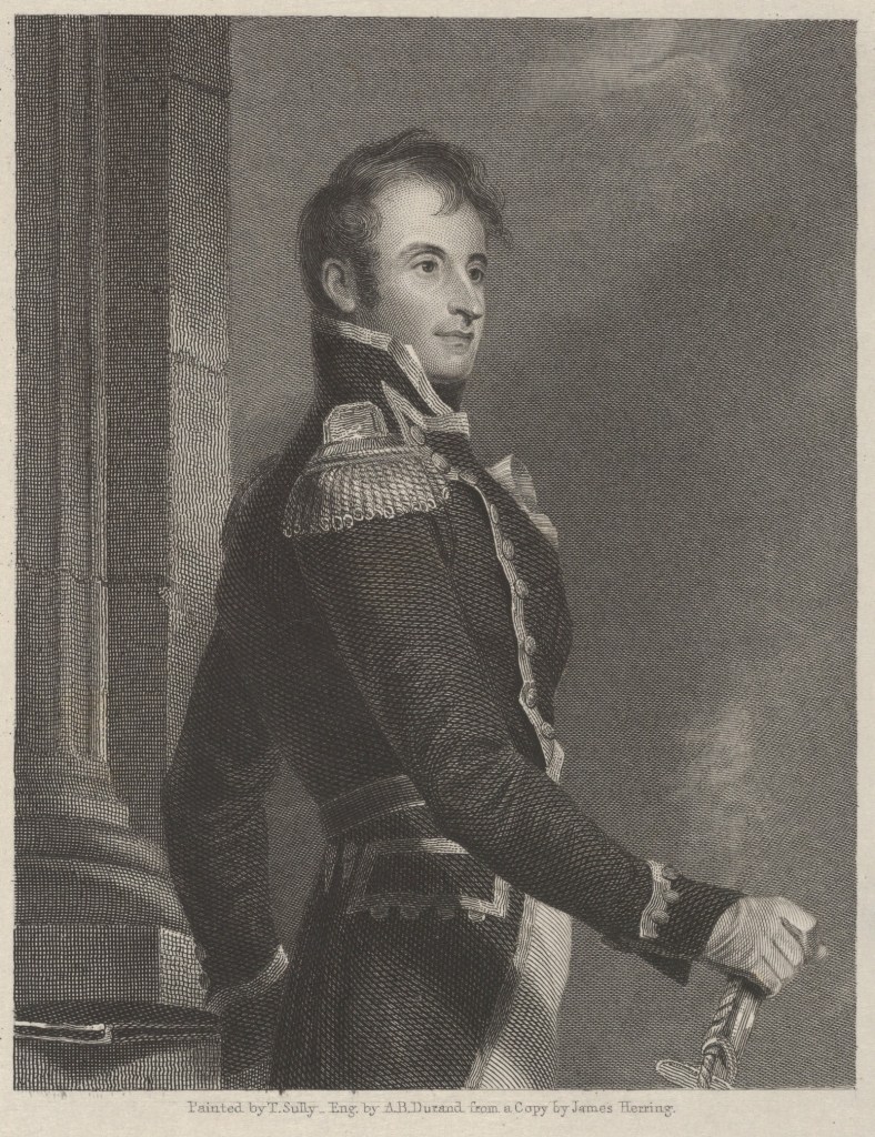
A little less than ten miles west of Ocean City, Route 50 passes Berlin, Maryland. In 1779, a man named Stephen Decatur was born near what is now Berlin. He was a daring and famous American naval hero. Here is one of his exploits.
* * *
On the night of February 16, 1804, the two-masted U.S. Navy ketch Intrepid sailed into Tripoli harbor, in what is now Libya, on the Barbary Coast of the Mediterranean Sea. Most of the ship’s crew hid beneath closed hatches as the lights of the city and the castle on the bluffs above grew closer. On deck, the ship’s officers were disguised as Mediterranean sailors. Stephen Decatur, their captain, stood with them, his hair pulled back and dark sideburns framing his face and its prominent nose.
Decatur directed his crew to steer the Intrepid through the night toward the largest docked ship, a captured frigate that had once belonged to the U.S. Navy. In the the middle of the harbor, voices called out across the water. The Tripoli harbor patrol had discovered them.
* * *
Decatur and his crew were in Tripoli Harbor because pirates from Tripoli, an Ottoman regency, had been capturing merchant ships and enslaving their crews for more than two centuries. During that time, the United States and European nations paid tribute to the pirates so ships could pass safely. As a result, Tripoli had collected enough booty to fortify the city and build a castle to guard its harbor.
In 1801, the Pasha of Tripoli increased the required tribute. European nations continued to pay, but the U.S. found the new amount unacceptable. In 1803, it dispatched a naval squadron to cow the Pasha and resolve the problem. The squadron included a 40-gun frigate, the Philadelphia.
And thus, one sunny day when the Tripolitan pirates were happily pillaging, they were unpleasantly surprised to see the Philadelphia and its 300-man crew bearing down on them. The pirates fled for the safety of Tripoli harbor. The Philadelphia gave chase, but the waters near the harbor were treacherous, and the Philadelphia ran aground on a sandbank.
The reprieved pirates surrounded the grounded ship. As more and more pirates arrived, the Philadelphia’s captain ordered his crew to push the ship’s cannon overboard, hoping to lighten her enough that she would float off the sandbank. It didn’t work, and when pirate gunboats fired at her, the Philadelphia couldn’t fire back. Her captain surrendered.
The pirates sent the Philadelphia’s crew away to prison and slavery. They hauled the Philadelphia off the sandbank and towed her into the harbor. Then they fished her guns up from the bottom of the bay, remounted them, loaded them, and ran them out ready to fire.
As a result, the Philadelphia represented a potent new pirate threat that the U.S. could not tolerate. The commander on the scene ordered up a raiding party to go into Tripoli harbor and destroy her. The idea was simple enough, but there were a few troublesome details:
A 25,000-man army defended Tripoli, and from the walls of the city and its castle 115 cannon overlooked the harbor. The Philadelphia was anchored well within range of those guns. A fleet of 24 vessels, ranging from galleys to sailing ships, patrolled the harbor itself. Those ships carried another 83 guns and an additional 1,000 men. Assessing the prospects, the U.S. commander said, “It will undoubtedly cost us many lives. But it must be done.”
Lieutenant Stephen Decatur, who commanded a ship in the American squadron, offered to lead the raid. He gathered his ship’s crew on deck and asked for men willing to go with him into Tripoli harbor. Every man volunteered.
Decatur and his men loaded a captured Tripolitan ship, renamed the Intrepid, with “combustibles,” 19th century naval terminology for things that burn fiercely.
On February 3, 1804, they set sail, but a gale blew up before they reached Tripoli. The direction of the wind prevented them from entering the harbor, and they had to wait for the storm to blow itself out. Their ship was about 50 feet long and, at its widest point, 15 feet wide. If you stand on a street corner today and look diagonally across the intersection to the other corner, that’s roughly 50 feet. Fifteen feet is approximately the length of one of today’s passenger cars. Seventy-five men were packed into that 50-by-15 foot space.
During the storm, waves rose above the level of the deck and crashed on board. Anything larger than the smallest scrap of sail quickly blew away, forcing the men to steer using only the pressure of the wind on the ship’s bare masts. For nine days, the ship rocked and pitched with every wave.
Decatur and his four officers shared a single tiny cabin with a ceiling so low they couldn’t stand upright. The midshipmen and the marines had only a crude shelter on deck, and they, too, risked banging their heads on the ceiling — when they sat up. The common sailors slept on top of barrels stored down in the hold. The barrels held the ship’s store of salt meat, but the meat turned out to be rotten, so Decatur and his men ate bread and water.
But in their hours of trial these men were not alone. Before it was captured, their ship had carried enslaved people of poor hygiene, and so they suffered from what one officer called an “attack of innumerable vermin.”
The gale finally subsided on February 16th, and that night Decatur and his men sailed into Tripoli harbor.
* * *
When the harbor patrol hailed the Intrepid, Decatur and his ship were already headed for the Philadelphia. Decatur’s pilot, a Sicilian who knew the harbor, replied in Arabic, saying they were from Malta and had lost their anchors in the storm. Could they tie up next to that big ship over there? The harbor patrol approved. The Intrepid’s crew had passed lines to the Philadelphia when the guards on its deck raised the alarm.
The Intrepid’s raiding party immediately swarmed up from their hiding places. With Decatur in the lead, they scrambled up the side of the larger ship and attacked the Tripolitan guards with cutlasses, pikes, and hatchets. Knots of men fought hand to hand across the deck, grunting and shouting amid the bang of pistols, the clang of edged weapons, and spurts of blood. Twenty guards were killed, and the rest ran for the railings and jumped overboard into the night.
Decatur’s men then handed up the combustibles from the Intrepid. To place and light them, the men climbed down steep ladders inside the Philadelphia and raced along low passageways through the dark, lower decks. Soon fire coursed through the ship. Orange flames leapt out of her hatches and climbed her masts, and acrid smoke choked the raiding party. The fire was so fierce it threatened to burn the Intrepid. The men tumbled back down off the Philadelphia on to their own ship, Decatur the last man off.
As the men pushed the Intrepid away from the Philadelphia and hoisted sail, ships guarding the harbor began to fire. Shore batteries opened fire, too, and cannon balls plummeted about the ship, sending up cascading fountains of water.
To the raiding party’s surprise, heavy guns also opened fire from close behind them. They looked back for this new threat and saw … the Philadelphia. Her guns, primed and shotted, were ready for action, and the heat of the fire set them off one by one, sending cannon balls whistling past the Intrepid and her crew.
Soon, though, the Philadelphia’s cables burned through, and she drifted ashore near the castle. When the flames reached her powder room, she blew up with a huge, deafening explosion. One of the Philadelphia’s captured crew, held prisoner in Tripoli, wrote, “Tumult, consternation, confusion, and delay reigned in every section of the town and castle.”
Decatur and the Intrepid sailed through the uproar and away into the night. Only one Tripolitan shot scored, and they only knew of it when a hole suddenly appeared in a sail above their heads. The total American casualty list: one man wounded.
The story of Decatur’s raid was told around the world. England’s Lord Nelson, the greatest fighting sailor of the time, called it “the most bold and daring act of the age.” When the news reached the United States, it caused a sensation. Decatur was promoted to captain, the youngest ever in the U. S. Navy. Congress awarded the Intrepid’s men an extra two-month’s pay — thirty-four dollars each.
As the country celebrated, a young man was inspired to take a popular English drinking song called “To Anacreon In Heaven” and write new words for it, commemorating Decatur’s feat. A few years later, this same man watched the British bombard Fort McHenry, and he revised his lyrics. And so Francis Scott Key took a song about Stephen Decatur and wrote “The Star Spangled Banner.”
Today’s Route 50 crosses the DelMarVa Peninsula (Delaware, Maryland, Virginia). This includes a part of Maryland that was quite familiar to Harriet Tubman, one of the most remarkable women in American history.
Harriet Tubman was born into slavery near Cambridge, Maryland in 1822, but in 1849 she freed herself by escaping to Philadelphia. Shortly after, an advertisement offering $100 for her return was placed in a Cambridge newspaper. We know this because copies of the ad still exist today.
She returned to Maryland frequently, but not as an enslaved person. Instead, on thirteen separate occasions she led members of her family and other enslaved people to freedom. She took her charges through the night in secret, using the resources of the Underground Railroad. She preferred to take those dangerous trips in the winter, when nights were longer and concealment easier. She often began them on Friday evenings, knowing the local newspapers wouldn’t report the escape until Monday. Her identity as the person leading these escapes was not known at the time, but as stories of her successes circulated she became known as “Moses,” for leading her people to freedom.
Her summary of that time: “I was conductor of the Underground Railroad for eight years, and I can say what most conductors can’t say – I never ran my train off the track and I never lost a passenger.”
During the Civil War, Tubman worked for the U.S. Army in various capacities, including as the leader of scouting patrols in the Confederate state of South Carolina. On one memorable occasion, she became the first woman to lead an armed assault in the Civil War, guiding troops on an expedition to the Combahee Ferry. That raid freed more than seven hundred enslaved men, women, and children.
But after the war, she struggled to receive a pension such as those awarded to male soldiers, and her activism, including in the campaign for women’s suffrage, kept her impoverished. Supporters had to raise money to help her.
Harriet Tubman died in 1913, at a home for aging African-Americans in Auburn, New York. Years before, she had helped to found that home.
In the photo below, Route 50 crosses southern Maryland between the Atlantic Ocean and the Chesapeake Bay. This section of the highway is dedicated to Harriet Tubman.
Harriet Tubman was here
___
The photo of Harriet Tubman at the top of this page is in the public domain. The photo of Route 50 was taken by the author.
Turn off Route 50 at Easton, Maryland, and head ten miles east on Maryland Route 33 to St. Michaels. Find a table next to the water at The Crab Claw restaurant.
This is a blue crab, named for its strikingly blue legs. The blue crab’s scientific name, callinectes sapidus, celebrates a combination of color, ability, and tastiness. “Calli” means beautiful in Greek, a tribute to the crabs’ color. “Nectes” is swimmer in Greek — by using their rear legs as paddles, these crabs swim very well. “Sapidus” is savory in Latin, because people like to eat them (see fine dining).
The savoriness of blue crabs means they are widely fished and eaten everywhere they live, from Nova Scotia in the north to Uruguay in the south. One of their favorite places is Chesapeake Bay, where in 2018 an estimated 147 million adult female blue crabs made their homes. Females have reddish tips on their pincers, and thus we know the crab posing for us at the top of the page is a female.
On the way from birth to adulthood, blue crabs molt several times. This means they outgrow their shells, shed them, and grow new ones. They typically live for one to three years, if they aren’t scooped up for dinner, and during that time they must deal with two things important to all living creatures, food and sex.
First, food: Blue crabs are not picky eaters; they will eat just about anything they can find. This means the tasty blue crab you just consumed likely ate, in its turn, clams, oysters, mussels, smaller crustaceans, dead fish, and plant and animal debris. Your crab may also have been a cannibal, having happily eaten smaller blue crabs, as well as fellow crabs who chose a bad time to molt and so were not protected by shells.
And now, let’s address matters of sex. Male blue crabs mate frequently, probably as often as they can. To attract a female, they wave their legs as though dancing. A female blue crab, however, mates only once during her lifetime. Could this difference demonstrate superior female morality? Maybe not. Perhaps it’s just the result of simple fatigue, since, after she mates a female blue crab produces from 750,000 to 2,000,000 eggs.
___
The photo at the top of the page is in the public domain from the U.S. Environmental Protection Agency.